News
Google and NASA JPL Unveil AI Model That Tracks Methane From Space
Google Research and NASA JPL's new MAPL-EMIT model identifies around 50 percent more plausible methane plumes than experts annotated, analyzing data from the EMIT satellite instrument. The dataset and code have been released for free public use, making it harder for polluters, including Polish coal mines, to hide their emissions.
Contents
Google Research and NASA's Jet Propulsion Laboratory announced on September 9, 2026 a new artificial intelligence model called MAPL-EMIT that automatically detects, measures and locates methane emissions worldwide using data from the satellite-borne EMIT instrument. The findings were described in a paper published in the journal Proceedings of the National Academy of Sciences.
How the Model Works
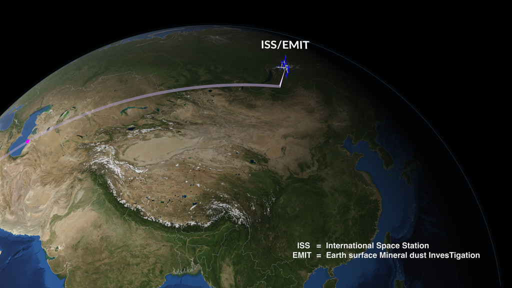
EMIT is an imaging spectrometer that has been mounted on the International Space Station since 2022, originally designed to study mineral dust over deserts but for some time now also used to detect methane. MAPL-EMIT is a network built on the Swin-S vision transformer architecture that analyzes the full light spectrum captured by the instrument together with the spatial context of neighboring pixels. The model performs three tasks at once: it estimates methane concentration, delineates the boundaries of the gas plume and pinpoints its source.
The paper's authors, research engineer Vishal Batchu and scientist Michelangelo Conserva from Google Research along with Anna Michalak, Philip Brodrick and Andrew Thorpe from JPL, trained the model on 3.6 million synthetic methane plumes generated through physical modeling and injected into real scenes captured by EMIT. This approach let them expose the network to far more leak variations than could be gathered from real-world observations alone.
Numbers That Stand Out
On a test set of 1,084 EMIT images, the model matched 84 percent of the plumes previously flagged manually by experts, while also finding half again as many potential emissions as the analysts had. In practice that means more than 23,000 additional methane clouds detected worldwide that had not previously been counted in the statistics. The model also pinpointed methane sources at 24 of the 25 largest methane-emitting landfills in the world.
The model captures 84% of expert-annotated plumes and identifies around 50% more plausible plumes, separating subtle signals from background noise - from the Google Research blog post
Why Methane Is a Priority
Methane has more than 30 times the warming potential of carbon dioxide over a hundred-year horizon and accounts for roughly a quarter of human-caused global warming since the start of the industrial era. More than 125 countries have signed the Global Methane Pledge, a commitment to cut methane emissions 30 percent by 2030 relative to 2020 levels. The trouble is that much of that pollution comes from individual, hard-to-locate sources such as landfills, mines and oil facilities that are easy to miss in manual analysis of satellite imagery.
Google has released a global database of detected plumes and methane concentration maps as collections on Google Earth Engine, along with a visualization app. The trained model and the synthetic training dataset were published on Kaggle, and the inference library was released on GitHub. That means researchers, investigative journalists and NGOs can independently check where methane is leaking around the world without waiting for official reports from companies or governments.
Poland Tops the Wrong List
An open tool of this kind matters especially for Poland, which according to 2025 satellite data is the largest emitter of methane from coal mining in the European Union. As much as 96 percent of all methane plumes observed over European energy infrastructure in 2025, or 109 out of 114 cases, came from Polish mines. Average emissions from Polish coal mining reached about 1,480 kilograms of methane per hour, more than twice the level seen at EU oil and gas installations.
The EU Methane Regulation has banned venting from mine degasification systems since January 2025, but satellites still detected such emissions at five Polish mines that same year. Poland, the EU's largest coal-methane emitter, has still not put in place a system of penalties for breaking that rule. Publicly available, more precise data from tools like MAPL-EMIT makes it harder to hide the scale of the problem and could speed up pressure from the European Commission to enforce the rules.
What's Next
Teams at Google and NASA say they plan to keep developing the model and expanding the EMIT data archive, which has been collecting observations of Earth from the International Space Station since 2022 and is expected to operate at least through the end of 2026. The project's open nature means other research teams can train their own models on the same data or integrate the detected plumes into local emissions monitoring systems.