News
Students and Researchers Use AI to Map the Gulf of Bothnia Seabed
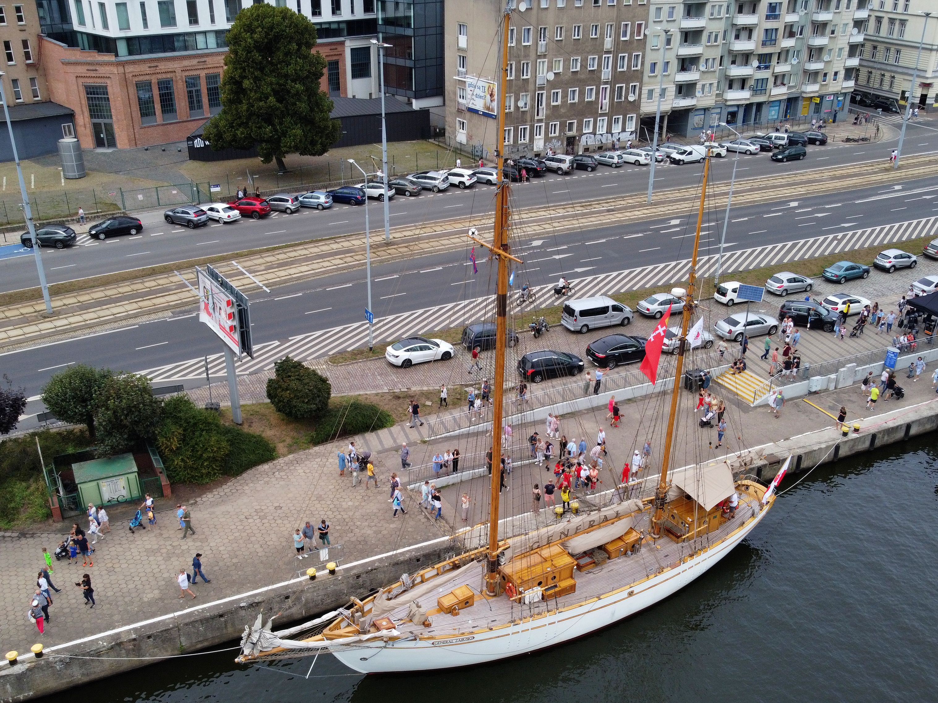
The AstroGeoBaltica 2026 expedition, running until August 1 aboard the tall ship STS Generał Zaruski, is using artificial intelligence to build digital terrain models aimed at explaining impact crater structures and post-glacial processes in the Gulf of Bothnia.
Contents
Aboard the training tall ship STS Generał Zaruski, geologists from the University of Wrocław are running a scientific expedition that pairs fieldwork with artificial intelligence algorithms. The goal is to better understand what lies beneath the water and the seabed of the Gulf of Bothnia, remnants of ancient collisions with space objects and of glaciers that once retreated across the region.
The Gulf of Bothnia, the northernmost part of the Baltic Sea between Sweden and Finland, has long drawn geologists' interest for its well preserved traces of the Ice Age and for impact structures, remnants of collisions with space objects from thousands or millions of years ago. The terrain is hard to study fully from a lecture hall, so the Wrocław team chose a model where the science happens directly on the water.
How the terrain models work
The research core of the expedition is building digital terrain models with the help of artificial intelligence. In practice, this means processing data gathered during the voyage, such as geological measurements, samples, and seabed imaging, into three-dimensional reconstructions of a landscape that existed thousands of years ago. The algorithms help spot patterns in the terrain's shape that a human analyzing the data by hand might miss, such as subtle rings left by meteorite impacts and later buried under glacial sediment.
This kind of modeling doesn't replace a geologist's fieldwork, but it does help pinpoint faster where it's worth looking for further evidence. Over the course of a single two-week expedition, the difference is tangible: instead of months of manual analysis of photos and measurements, preliminary hypotheses take shape while the team is still on board.
A ship as laboratory
The expedition's operational base is the STS Generał Zaruski, one of the oldest active Polish training tall ships, built in Sweden before World War Two and serving Gdańsk's maritime education program for years. Until July 17, the ship hosted the eleventh edition of the Gdańsk School Under Sail, during which young people learned navigation and sail handling under Captain Marcin Dobrowolski. When the young sailors stepped ashore in Turku, researchers and students from the University of Wrocław took their place.
In total, 25 people are aboard: 12 students and PhD candidates, five academic staff, two professional educators, and a permanent six-member crew led by Captain Adam Walczukiewicz. The program combines geological research with hands-on sailing instruction and maritime education, which the organizers treat as just as important a part of the project as the scientific results themselves.
I knew that living in a small space brings people together, but I didn't realize how much it also changes these young people beyond that. I'm watching them now, and a large share of them are absolutely transforming. They're becoming leaders, gaining courage, and making decisions they wouldn't have made before - Dr. Magdalena Modelska, Institute of Geological Sciences at the University of Wrocław, expedition organizer
Third edition of the project
AstroGeoBaltica 2026 is the third run of this format combining a training voyage with scientific work, following earlier geological expeditions organized by the University of Wrocław, including trips to Arctic regions. This time the starting and finishing point is Turku, Finland, and the program runs until August 1, 2026. Alongside the analysis of impact and post-glacial structures, participants take part in workshops on modern science journalism and public communication, meant to help later translate research findings into language accessible to a broader audience.
For Polish science, projects like this matter beyond their geological findings alone. Pairing students with real research equipment and AI-based methods in field conditions rather than purely in the lab is still rare at Polish universities, which more often limit themselves to classroom-based coursework.
Why it matters for AI in geology
Using artificial intelligence to build terrain models fits into a broader trend in earth sciences, where machine learning algorithms increasingly help identify geological structures from satellite, sonar, and field data. Similar approaches are already used to detect previously unknown volcanic calderas on the ocean floor or craters on the surface of Mars, and now they've made their way onto a Polish training tall ship as well.
The expedition's results, including the completed terrain models, are set to be worked up after the team returns to Wrocław. The organizers plan to continue the format in coming years, with new research regions and new cohorts of students learning to apply AI tools directly in the field rather than only on university computers.